 We went out on a 53 miles ride today joined by five of our friends. Never been in that part of London before and it really didn’t feel like London. Even though we were within the M25, pretty much London still, we enjoyed some rather nice country lanes.
The weather meant that we had to put on our waterproofs four times before we managed to get home as we enjoyed four rather hard showers. During one downpour we had to pull over and wait under a bridge as we couldn’t see where we were going. At least it was not cold so we didn’t end up freezing our bits off.
It was the first time I have really used my new Dakota 20 from Garmin. Before I have only played around with it here in London where I know the roads.
There are two ways of using the Dakota (I think), one which is very close to the typical DumDum erm TomTom where it will tell you when to turn with a beep and show you a big fat arrow on the screen. You can plot a route that way but you are limited to 50 points which made our route impossible to plan as there is a good chance that it would send you down the wrong roads.
The other way is to create a track and follow that, that means you will not get a warning beep when you approach your turns. So you really need to keep an eye on it and not chat away in the good company you are in and miss your turn. And with using OSM some of the turns we took didn’t look the same on the GPS as it did in real life, so we had to to a u-turn again.
I come to the understanding that there should be way to mix these two options but yet to figure out how. Though I might be wrong on that.
At one point the map on the GPS didn’t load so I was riding blind and at an other point the track wasn’t showing so I didn’t know where to turn. A restart sorted both of these out, Windows kinda rings a bell here 🙂 I’m not sure if it was my track that had too many points or the OSM I used that caused the GPS to freak out a bit. But one thing for sure I will be taking a paper map with me when touring in unknown territories.
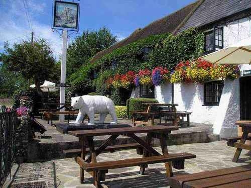
Oh yeah the White Bear in Warlingham is well worth a stop, great ales and nummy food and soon to be installed Sheffield stands for your secure bicycle parking.
I’m surprised if the Dakota 20 is limited to 50 points for a route, since I thought it used pretty much the same software as my GPSMAP 62s (albeit with somewhat different hardware), which I believe allows 250 points for a route.
Still, I’ve only had mine for a few days so I’m still experimenting with it. Using the Autorouting into work this morning was fun, although it kept wanting me to cycle along footpaths on Clapham Common, which I imagine is an OpenStreetMaps issue.